Bab el-Mandeb
Updated
What it is
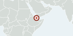
The Bab el-Mandeb is a narrow strait, about 26 km wide, between Yemen and Djibouti and Eritrea at the southern mouth of the Red Sea. It sits on the sea route from the Gulf to the Suez Canal and carries about 12 percent of world seaborne trade and, in 2023, 8.7 million barrels of oil a day.
Why it matters lately
With Hormuz blocked, Saudi Arabia rerouted crude through its Red Sea port of Yanbu, and Saudi exports through the Red Sea rose from 7 million barrels in February 2026 to nearly 100 million in June. Yemen's Houthis joined the war in June, began a blockade of Saudi tankers on July 22 and claimed their eighth tanker attack on August 5. By September 2026 they were nearing control of the coastal towns on the strait itself.
Asymmetric Analytics view
Inference (AA): It is the graph's second Middle East chokepoint and the exit route for Saudi exports that bypass Hormuz.